![[Valid Atom 1.0]](valid-atom.png "Validate my Atom 1.0 feed")


The National Oceanic and Atmospheric Administration's web update on Sunday, May 23, said "Shoreline assessments and overflights continued today as planned. As anticipated, areas of oil moved closer to the Chandeleur Islands today. With winds forecast from the north, this will tend to push the oil away from shore. However, the threat of oil impacting the coastline remains high."
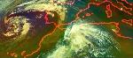
Image Credit: NASA/Goddard/Terra
Text Credit: Rob Gutro, NASA's Goddard Space Flight Center


